
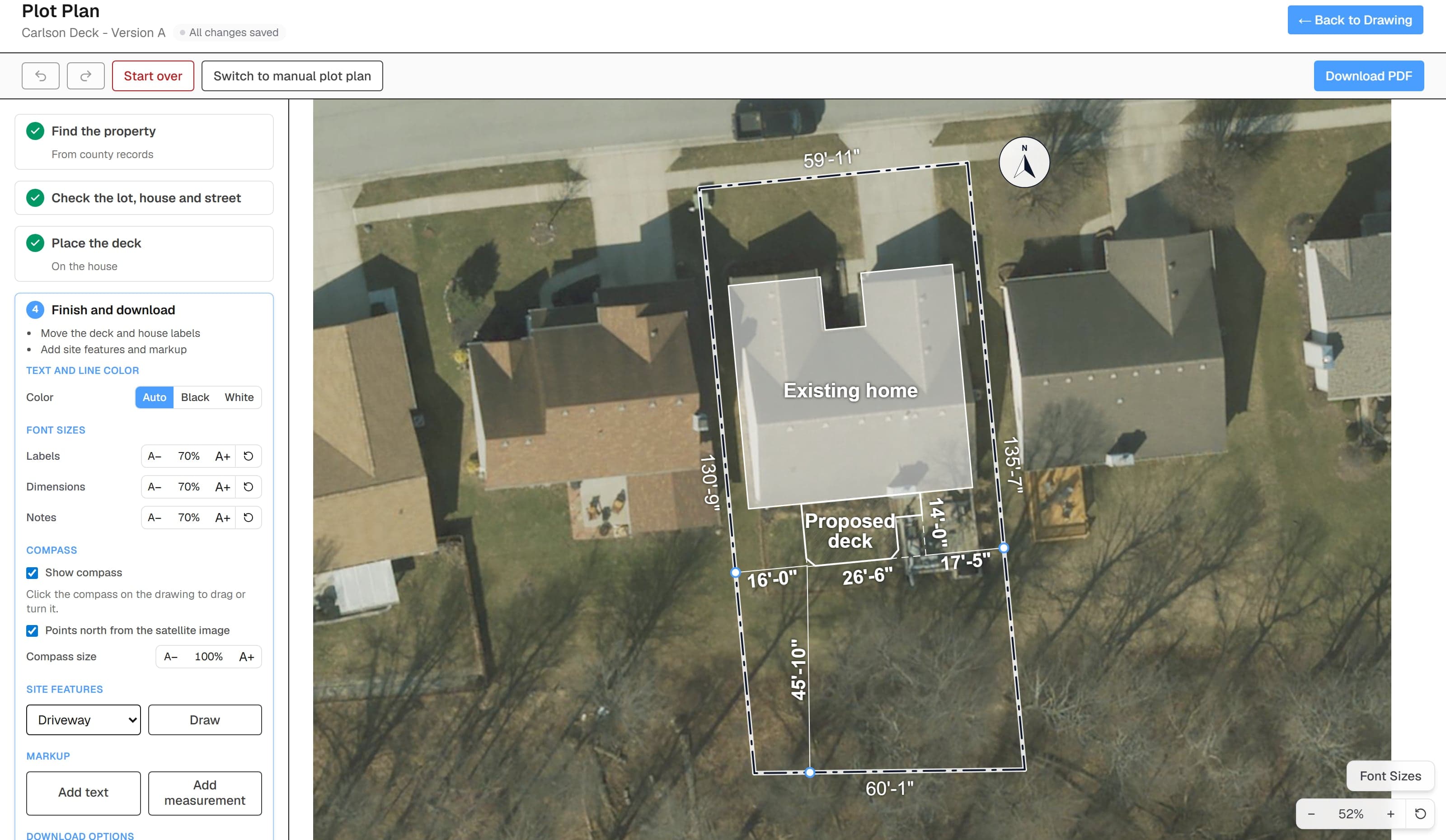
Satellite imagery
See the yard without driving back out.
The satellite image shows you everything from the house to the driveway, and the trees to the fence line. It optionally prints faded behind the plan so the permit office sees the real property.